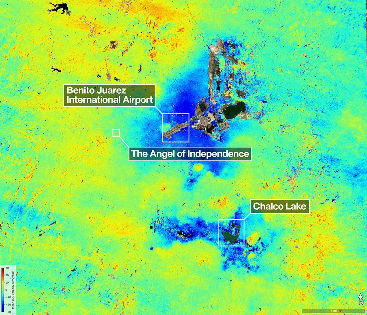
A scientist produced this map of land subsidence (sinking) in Mexico City using data from the NISAR (NASA-ISRO Synthetic Aperture Radar) mission captured
One of the most powerful radar systems ever launched into space has mapped the ground moving beneath one of fastest subsiding capitals in the world: Mexico
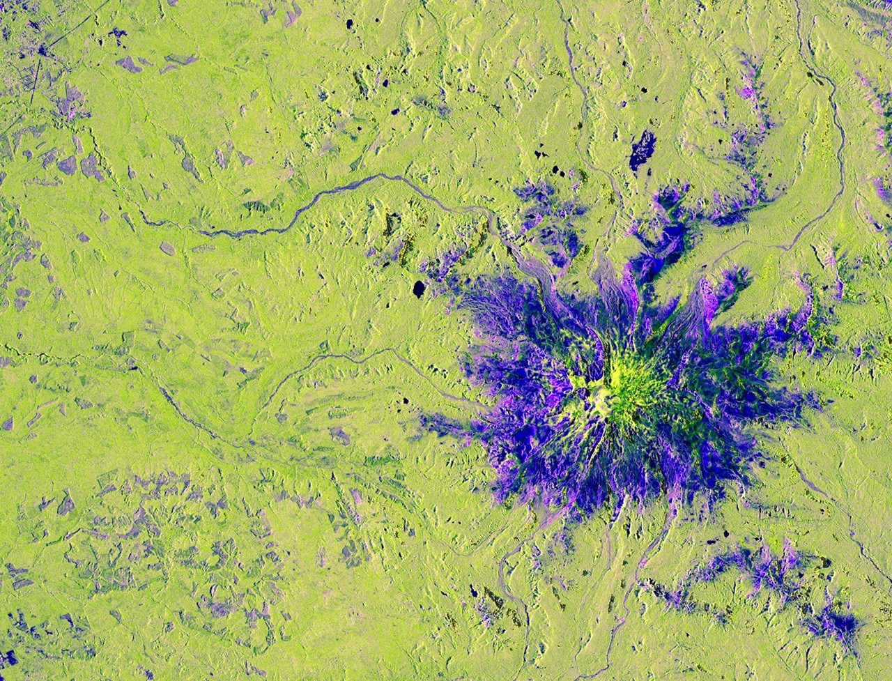
This image captured by U.S.-Indian Earth satellite NISAR on Nov. 10, 2025, shows Washington’s Mount Rainier. The image is cropped from a much larger swath