Menu

#Mapping

14 posts

Feed·
14 of 14 posts
How to Build a Customer Journey Visualization in 30 Minutes: AI-Powered No-Code Guide
🖼️
0Read More

How to Build a Customer Journey Visualization in 30 Minutes: AI-Powered No-Code Guide

DEV Community: ai·Fan Song·5 months ago
#YnezBG2N
#dev#journey#customer#minutes#mapping

Key Takeaways Customer journey maps are visual representations of how users move through your...

15s
Top 7 Tools for Customer Journey Mapping to Enhance User Experience
🖼️
0Read More

Top 7 Tools for Customer Journey Mapping to Enhance User Experience

Small Business Trends·Linda Taylor·5 months ago
#wV4IKUj0

Discover the top 7 customer journey mapping tools to enhance user experience. Learn how these essential tools can help you visualize and optimize your customers' journeys for better engagement and satisfaction.

15s
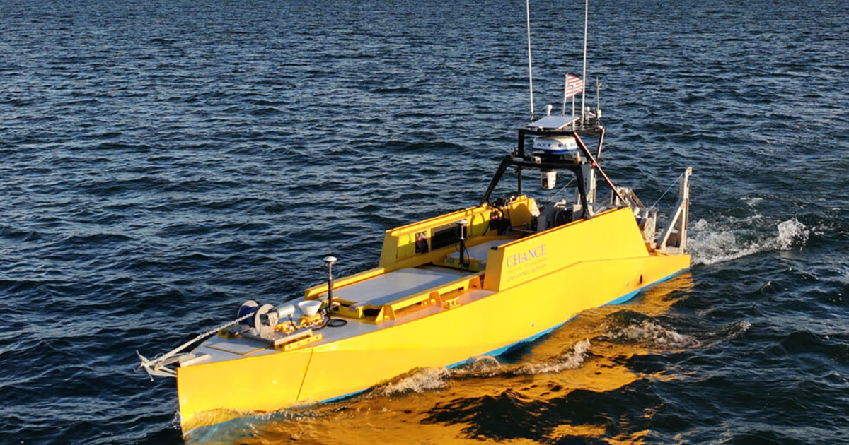
Chance Maritime Awarded NOAA Contract To Provide Chance LR30 USVs | Ocean News & Technology
🖼️
0Read More

Chance Maritime Awarded NOAA Contract To Provide Chance LR30 USVs | Ocean News & Technology

Ocean News & Technology·5 months ago
#4uOhP91a

Chance Maritime Technologies to support NOAA’s next generation of charting and mapping operations with a flexible, mission-ready USV platform designed and built in the USA.

15s
NASA airplane in Colorado Springs mapping the West for critical mineral resources
🖼️
0Read More

NASA airplane in Colorado Springs mapping the West for critical mineral resources

Colorado Springs Gazette·Alex Edwards·6 months ago
#dJklatrX

A NASA airplane designed around the U-2 spy plane of Cold War fame is calling Colorado Springs home, flying from the Colorado Springs Airport as the U.S. Geologic Survey and NASA partner to survey Western states for critical minerals.…

15s
USGS, NASA Map Critical Minerals from 65,000 Feet
🖼️
0Read More

USGS, NASA Map Critical Minerals from 65,000 Feet

USGS·6 months ago
#Ve1B820U
#usgs#earth#mapping#mineral#hyperspectral

COLORADO SPRINGS, Colo. — The U.S. Geological Survey and NASA announced an addition to the world’s largest airborne hyperspectral survey – a digital portrait of critical minerals and geology in the American West, taken from 12 miles up.

15s
Let Claude Code Debug Your Obfuscated Python: A Guide to the pyobfus MCP Integration
🖼️
0Read More

Let Claude Code Debug Your Obfuscated Python: A Guide to the pyobfus MCP Integration

DEV Community·Rong Zhu·6 months ago
#zDzBEBFU
#ai#python#mcp#claudecode#pyobfus

From Dev.to - python: Let Claude Code Debug Your Obfuscated Python: A Guide to the pyobfus MCP Integration

15s
Fishing, Mining, And Warfare - The Surprising Reason China Is Mapping The World's Oceans
🖼️
0Read More

Fishing, Mining, And Warfare - The Surprising Reason China Is Mapping The World's Oceans

BGR·Alec Hively·6 months ago
#7zbu2asq
#facebook#twitter#instagram#flipboard#china

China is mapping the ocean floor at an unprecedented scale. See why experts warn this deep-sea mission could fundamentally change the future of naval warfare.

15s
Delhi gears up for SIR: Govt tells staff to verify names, details against previous electoral lists
📰
0Read More

Delhi gears up for SIR: Govt tells staff to verify names, details against previous electoral lists

The Indian Express·Gayathri Mani·6 months ago
#mqmc9XMx

The Delhi government has over 5,000 employees, and over 400 bureaucrats. Besides, there are contractual employees and class 3 and 4 level staffs.

15s
Maharashtra CEO seeks EC nod for online self-mapping option for voters as pre-SIR exercise falls behind
🖼️
0Read More

Maharashtra CEO seeks EC nod for online self-mapping option for voters as pre-SIR exercise falls behind

The Indian Express·Alok Deshpande·6 months ago
#U8O9Gxm9

BLOs have matched fewer than half of Mumbai's voters to a 2002 electoral roll, prompting the CEO to propose online self-mapping — even as the EC is yet to announce the SIR schedule

15s